Blakey Paleogeographic Maps
New Digital Collection of Paleogeographic Maps Offers Glimpses into Deep Time
The nearly 900 maps, spanning hundreds of millions of years, show the shifting distribution of ancient seas, ocean basins, glaciers, mountain ranges, tectonic features, and continents. Thanks to a generous donation from Charlie Bartberger, Class of 1967, the Department of Geology and Environmental Geosciences and the Libraries’ Digital Scholarship Services Department acquired three series of paleogeographic maps from Colorado Plateau Geosystems: Global Paleogeography and Tectonics in Deep Time, North American Key Time-slices, and Paleogeography of Southwestern North America. Members of the Lafayette community can explore the collection by logging in to the Lafayette Digital Repository.
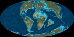
Example of one of the Paleogeographic Reconstruction Map